-40%
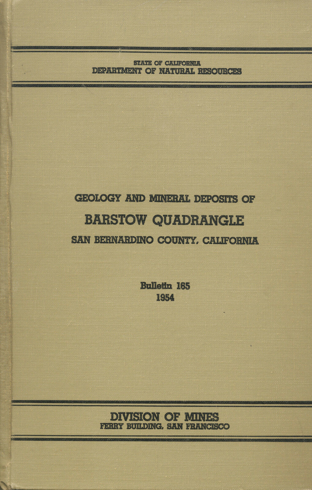
BEST BOOK ever on Barstow, Calif, GOLD MINES Mojave Desert, last one, RARE, vg+
$ 68.51
- Description
- Size Guide
Description
Scarce 1954 1st-ed. book & maps pinpoint MojaveDesert gold & silver mines near Barstow, CA
First-edition HARDCOVER is in very good condition;
has all
NINE
big ORIGINAL separate maps in rear pocket
Has more details about area mines and geology than county report
T
his rare first-edition hardcover describes every mine (including gold and silver mines) in a BIG chunk of Mojave Desert — 976 square miles of it — surrounding Barstow, California.
Tiny portion of big (22-by-22 inch) separate map from pocket —
Economic map of the Barstow quadrangle, California —
shows just a few mines near Silver Mountain. Every "Au" symbol is a gold mine; every "Ag" is a silver mine. "Cu" is for copper.
It also is jam packed with geology information about this area, including how the various ores formed.
It took us a year to find this one with none others in sight. Could be the last one listed for a long long time. So buy it now or potentially wait for years for another.
It's a first edition in GREAT shape — with all
NINE
big separate maps and aerial photos bulging in the rear pocket. And those maps are guaranteed originals (with some in color). NO map copies here.
The report has exact mine locations, geology, ore value, mine-production stats, history, even claim holders' names and addresses. This is the most comprehensive mining report ever written on the Barstow quadrangle. There is absolutely no government report that better covers this area. Nothing even comes close, so grab it today or forever hold your peace. Once it's gone, it's gone!!!!
Reprints = NO maps
Some cheesy Chinese and Indian illegal reprints of some mining books are now appearing on the market. BEWARE: Besides having some of the worst printing on the planet, NONE of the photos are clear. They look like 1969 photocopies. You can't tell if it's a picture of an elephant or a mine. Plus, more importantly, NONE of these reprint books have the maps, not even copies of the separate maps. They have no separate maps. None. Zero. And these reports are absolutely worthless without the separate maps. If these reprints were any good at all, I would be selling them, but they're garbage and incomplete and useless.
Covers much more than other reports
What's more -- reports that cover the whole county
DO NOT
have the level of detail about about the Barstow area. How could they? They don't have room. One county report has 150 pages devoted to the whole county. This report has 208 pages, and every single one of them is about just the Barstow quadrangle. The county-wide report has one separate map. This report has NINE big separate maps and aerial photos in the rear pocket, including one map in color. (See "The Book" section for more map-condition info.) these are all original maps; NO copies. And all maps are in nice condition.
Some mines are OPEN to prospecting
And many of these mines are on BLM or public land and COMPLETELY open to exploring and prospecting. They are MILES from any population center, so there's no one to bother you no matter what you do (we are NOT condoning anything illegal). No fences, no no-trespassing signs, no barking dogs.
It is EXTREMELY likely that much gold and silver is still waiting to be extracted by some guy who decided to dig when everyone else sits around, drinks beer and says, "It can't be done." Get out your Gold Bug Two detector, and shoot some two-pound nugs. Or better yet, dig down to bedrock in washes around gold deposits and do some lucrative panning, wet or dry.
I have personally detected and panned in this area and have been VERY successful.
We have many MANY more rare mining books! Just search for our ebay store, Rare Mining Books:
http://stores.ebay.com/Rare-Mining-Books?_rdc=1
Easier than
going to Alaska
You've watched the COMPLETE idiots on the Gold Rush Alaska TV show finally strike it rich. There is no need to travel to Alaska when HUGE riches could be waiting just a couple hundred miles east of L.A.
The mines are plainly described in the text and even more plainly marked on the maps.
Yes, the area is a bit remote, but where did you expect to find undiscovered gold in California? At the Orange County Fairgrounds in Costa Mesa?
4WD vehicle not needed
Don't have four-wheel-drive? Not to worry. Much of the area in this report is within striking distance of graded dirt roads. And it's a cinch to correlate the area in this report with the Auto Club San Bernardino County road map that I mentioned before.
This is not some gift-shop rockhound book; it was prepared by the California Division of Mines and Geology 53 years ago. It contains much valuable information for history buffs, bottle collectors, paleontologists, photographers, rockhounds, prospectors, hikers, offroaders, geologists, metal detector enthusiasts — just about anyone interested in the Mojave Desert's geology and historic old mine sites. This report is considered primary source material; much of this info is available
nowhere else
.
Exact coordinates
This first-edition book gives exact locations of
all
mines in the Barstow quadrangle — including gold and silver mining sites, some in remote unpopulated areas of Mojave Desert wilderness. The mines are sometimes located using landmarks, but most are pinpointed with
infallible range-and-township coordinates
. Road names or landmarks may have changed radically in the last 53 years, but these coordinates have not. Just plug 'em into your GPS or look 'em up on the appropriate topo, and you're there!
Not only that, the mines are also shown on the big separate maps from the report's rear pocket. And two of these maps are not vague sketch maps, but exacting color topos — showing altitude contours and rock types across the whole quadrangle. How can you look for gold, silver or minerals in mine dumps if you don't know exactly where the best dumps are? Don't waste weekends randomly hammering away at barren rocks or digging through tailing piles for specimens.
Mines and prospects covered include:
Iron hoisting frame and horse-whimsey at the Amazon copper mine on Quartzite Mountain.
Carbonate mine
— 1.5 miles from Oro Grande, "known for its high-grade gold ore." The best ore was found at or near the contact of the vein system and a dike of light colored, much-decomposed rock resembling feslite. Ninety feet of drift was driven on the 200-foot level and 40 feet on the 60-foot level.
Branch mine
(also called the Whatnot, Four Brothers and Del Oro) — near Bryman. Discovered in the 1880s, in 1889 it produced ore that ran in gold and in silver per ton. A 300-foot tunnel is the principal working, but there are two raises to the surface.
Oro Grande
— a very old mine first operated in the 1880s. Had a 250-foot deep timbered shaft. A stamp mill at Oro Grande once processed ore from this mine.
Sidewinder mine
— near Victorville, first recorded production was 1889; 10-stamp mill in Victorville processed the ore. "The Sidewinder is by far the most extensive and has the greatest recorded production of any gold mine in the Barstow quadrangle."
Kramer Hills
— operated in 1926 by the Shaherald Mining Company, Rialto.
The Hello Al Group
— consists of 12 claims along two parallel veins.
Golden Witch, the Anaco and more.
Also a valuable tool for stock certificate collectors
Because this first-edition report lists mine owners and different names for the same mine, it is also a valuable tool for collectors of stock certificates. Some mine descriptions not only contain brief histories of the mines in question (including dates of actual production) but also include the names of previous owners.
This book covers one big chunk of desert real estate in San Bernardino County (see map below). Barstow quadrangle stretches north from the the San Bernardino Range and Lucerne Valley to Harper Dry Lake. The center of the area is 42 airline miles north of San Bernardino or 30 miles northeast of the summit of Cajon Pass. Barstow is only a few miles from the northeast corner of the quadrangle, and Victorville is near the southwest corner. The Shadow Mountains adjoin the quadrangle on the west and the Ord Mountains on the east. Interestingly, newer roads in this area are plainly marked on the Auto Club of Southern California San Bernardino County road map, so the road map can be used easily to correlate exact mileages to mines and other geologic features on the maps from this book.
Map from book shows location of Barstow quadrangle in relation to other counties, the Garlock fault and the San Andreas fault.
Don't rely on secondhand information
Okay, so you have a book by a "noted rockhound" or an "ace prospector." You might get lucky and find a couple of neat places, but you'll also hit plenty of absolute duds. Why? Because what rockhound, mine explorer or prospector in their right mind would give away their favorite productive locations? Not one. What they will give you are directions to sites that are picked clean or second rate at best. Don't rely on secondhand information when you can get firsthand info from this 208-page book.
Predict and find NEW gold deposits (and find existing mines) with
Geologic map of Barstow quadrangle, California,
a big full-color map in rear pocket. Only small section of map is shown. They don't make 'em like this any more.
Want to prospect or collect at virgin, undiscovered locations instead of ones already known? Then you'll need to find new areas with geologic attributes conducive to containing the minerals or fossils that you're seeking. This book and map has that too (see map at left). Who knows, maybe you'll discover the next Lost Burro gold mine.
Recovered materials
from this area include:
Gold, silver, copper, iron, silver-barite, tungsten, asbestos, barite, clay and magnesite.
Large maps folded in pocket
Like other sought-after mining and geology books about the Mojave Desert, the oversize folded maps are arguably the real prize here. They would look
great
framed if they weren't so useful in the field. Then again, you could have the best of both worlds: Make copies of them for the field, and frame the originals. The geologic map (detail at left) is a particularly handsome example of geologic cartography with pleasing colors and nicely executed calligraphy; they just don't make 'em like this any more.
Book describes geology in detail
Because this is, after all, a book about mining
and
geology, it covers the latter topic in minute detail (almost 140 pages worth). Mesothermal gold-bearing quartz veins have been found and worked on various scales at numerous places in the quadrangle. Ore bodies occur in fissure veins, most of which strike roughly north or east. Primary ore minerals consist of pyrite, chalcopyrite, sphalerite and rarely bornite, as well as free gold. The sulphides commonly act as hosts for gold deposition. Oxidized minerals commonly are limonite and malachite.
Of course, the text contains far, far more detail about geology — especially how it relates to mineral deposits and their formations — than just the previous paragraph. Geology varies widely over an area the size of this quadrangle, so it is impossible to convey but the simplest geologic features in an ad.
Maps in the rear pocket include:
"Geologic map of Sidewinder mine area and aerial photograph."
"Geologic structure sections across Barstow quadrangle, San Bernardino, California."
"Outline geologic map of Quartzite Mountain, with aerial photograph."
"Geologic map of the Hodge area and aerial photograph."
Plus five others (see scans throughout the ad; one map may be a copy; please see "The Book" section later in this ad for map condition).
Another tiny detail of map from pocket shows more gold prospects, marked with crossed-pickaxe symbol and "Au," the elemental abbreviation for gold.
Area has changed
Interestingly, this area has changed markedly in the 53 years since this report was published. This chunk of western Mojave Desert was once even less populated than it is now. The big maps from the rear pocket reflect this, showing few streets and towns, making it valuable not just for those interested in area geology, but also for those seeking information on the large impact that rural sprawl has had on what was once true backcountry.
Where is it?
The Barstow quadrangle is in San Bernardino, California. Adjacent counties are
Riverside, Orange, Los Angeles, Kern and Inyo. Barstow quadrangle (seee map, bottom left) stretches north from the the San Bernardino Range and Lucerne Valley to Harper Dry Lake. The center of the area is 42 airline miles north of San Bernardino or 30 miles northeast of the summit of Cajon Pass. The Mojave River is one of the quadrangle's dominant features.
The book:
Geology and Mineral Deposits of the Barstow Quadrangle, San Bernardino County, California
, Bulletin 185, 1954, by Oliver E. Bowen Jr., California Division of Mines, San Francisco, CA, 208 pages, six by nine inches hard cover, 84 illustrations plus nine ORIGINAL oversize maps in rear pocket (NO copies).
In very good condition with some cover wear. Slight corner bumps; few slight spots on page edges; some small owner stamps. Pages are slightly yellowed as are the maps, pretty much stndard for ALL these books. Tiny bit of chipping on a couple page and map edges.
Nine BIG OVERSIZE maps (one in color) and aerial photos in pocket are folded with some slight rippling. Folds are not worn and exceedingly sturdy.
All in all, one of the best copies that I have seen of this rare mining book.
As always, I am
extremely
conservative about rating book condition and very detailed in listing any potential flaw, no matter how slight. You get what you pay for. If you want a trashed book — filled with torn and dog-eared pages that the seller just "somehow forgot" to tell you about in his ad — then look elsewhere on ebay.
Payment methods and domestic shipping
Paypal only. I pride myself on bulletproof packaging and ship in sturdy cardboard boxes or heavily reinforced padded envelopes. I had to slightly raise prices because postage is through the roof with recent hikes.
The fine print:
Feel free to e-mail me if you have any questions about the item or terms of sale.
I post feedback once a week. Not responsible for typographical errors.
Good luck and thanks for looking!
Towns, cities and nearby counties
Towns, cities and notable features in the quadrangle include Barstow, Hinkley, Eads,
Jimgrey, Iron Mountain, Kramer Hills, Lenwood, Hodge, Wild, Stoddard Mountain, Stoddard Well, Daggett Road, Fairview Valley, Apple Valley, Victorville, Leon, Oro
Grande, Bear Lake Road, Frost, La Delta, Bryman, Las Cruces Ranch, Adelanto, Turner Springs and Randsburg Transmission Road.
San Bernardino County is in southeastern California, bounded on the east by Arizona and Nevada; on the south by Riverside County; on the west by Los Angeles and Kern Counties; and on the north by Inyo County. Nearby counties include Imperial, San Diego, Ventura, Santa Barbara, San Luis Obispo, Kings, Tulare and Mono.
Other San Bernardino County cities and towns (besides the ones previously mentioned in this ad) include: Adelanto, Alta Loma, Apple Valley, Barstow, Big Bear Lake, Bloomington, Chino, Cima, Colton, Cucamonga, Essex, Etiwanda, Death Valley Panamint Village, Fontana, Forest Falls, George Air Force Base, Grand Terrace, Havasu Landing, Helendale, Hesperia, Highland, Hinkley, Lake Arrowhead, Loma Linda, Lucerne Valley, Mentone, Montclair, Morongo Valley, Mountain Pass, Mt. Baldy, Needles, Ontario, Oro Grande, Parker Dam, Phelan, Pinon Hills, Pomona, Rancho Cucamonga, Redlands, Rialto, Upland, Yermo and Yucca Valley.
